
|
Accessories
Hooks
|
Rods
Reels
|
Lines & Braids
Lures
|
Tools & utilities
Harnesses & Belts
|
Bottom Fishing
Fish Attractor
|
|
Fighting Chair
Triggering clip
Deep Fishing
|
Outriggers
Chandlery
Downriggers
|
GafFs & Bats
Electonics
Fish Chum Dispensers
|
Kites Fishing
Binoculars
|
|
|
Hats
Visors
Caps
|
Gloves
Short
T-Shirt
|
Pants
Sweaters
Jackets
|
Towels
Neck Srap
Glasses
|
|
|

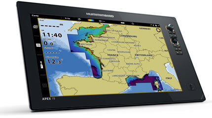
082324055195
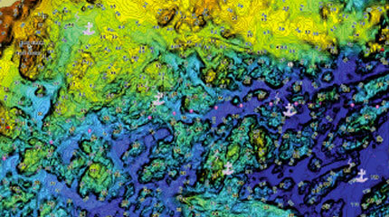
Humminbird's CoastMaster France map offers highly accurate map coverage of the entire French and Corsican coastline.
From easy-to-read contours to highlighted depth ranges, you'll have the tools you need to find the best fishing spots and navigate them safely.
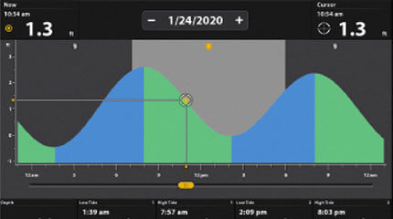
Tides & Currents provides current speed and direction, as well as tide height and direction.


VX Vector cards offer exceptional performance and the ability to change color palettes.
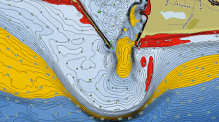
Simple and easy to switch from fishing to nautical charts, or create your own display settings
Provides current speed and direction, as well as tidal height.
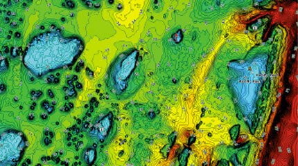
Create up to four depth highlight ranges and a red shallow water highlight. Also synchronize depth contours with changing water levels and identify areas uncovered during low tide.
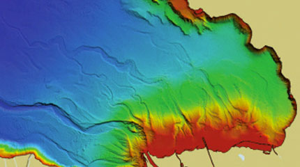
Quickly identify the best fishing spots thanks to the shaded relief, which makes it easier to understand the water bottom
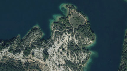
Navigate with confidence and identify new fishing spots with aerial imagery.

No customer reviews for the moment.
Humminbird's CoastMaster France map offers highly accurate map coverage of the entire French and Corsican coastline.
From easy-to-read contours to highlighted depth ranges, you'll have the tools you need to find the best fishing spots and navigate them safely.
Tides & Currents provides current speed and direction, as well as tide height and direction.